- Students will use political and physical maps to complete their own reference map of Europe which identifies major regions and answers questions about geographic features.
- This station is worth 12 points.
- The directions for this station are on the worksheet that you will submit and on the website as well.
THERE IS A DOCUMENT IN THE CRATE AT THE BACK OF THE ROOM WHICH YOU MUST COMPLETE FOR THIS STATION.
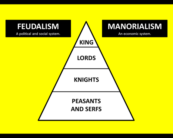
LEARN THIS:
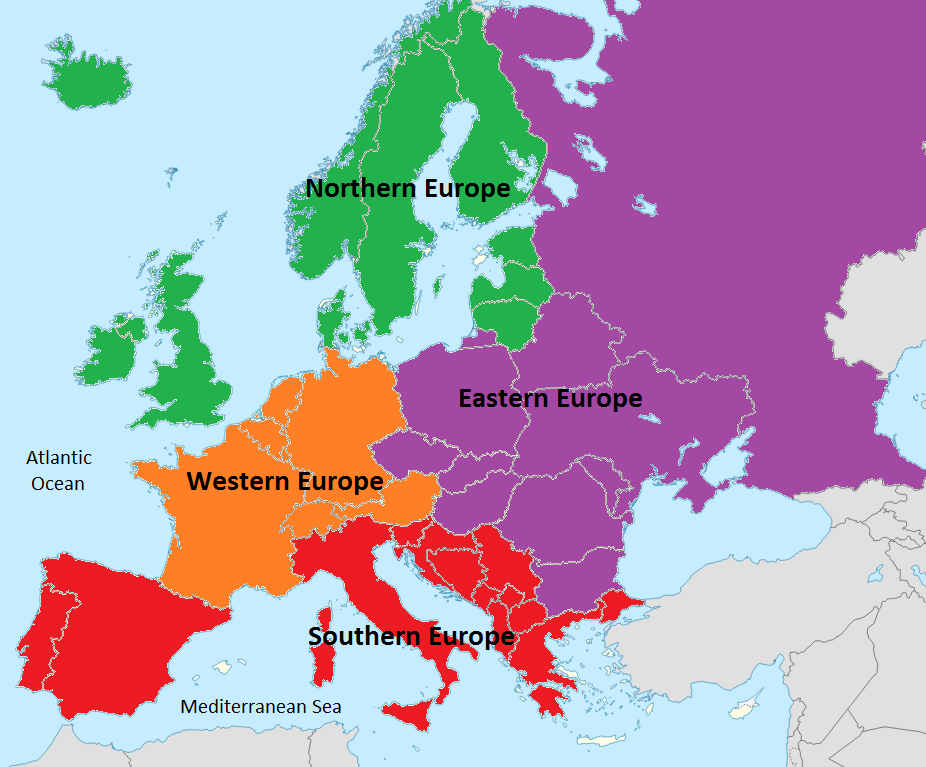
Borders and territory were not as clearly defined before the modern age. Today, the lines on a map are firm boundaries between different countries. Instead we think in terms of large regions which share common cultural and political characteristics to organize our thoughts about different historical civilizations and their location.
In Europe there are four very broad regions to define according to the United Nation. In this unit you will have opportunities to learn about the common historical events, interactions, and cultures that linked different civilizations in the regions of Northern, Eastern, Southern, and Western Europe.
DIRECTIONS:
To create your Europe Reference Map you will complete the following:
- Color and label the regions identified in the map posted on the website.
- Label the Atlantic Ocean and Mediterranean Sea.
- Identify the cardinal directions on the map’s compass.
- Check the map of Europe in the textbook or look one up online and identify at least one country per region of Europe.
meet this expectation for that region.