THIS WORK IS TO BE COMPLETED ON THE WORKSHEET WHICH YOU CAN FIND IN THE CRATE.
LEARN THIS:
Borders and territory were not as clearly defined before the modern age. Today, the lines on a map are firm boundaries between different countries. Instead we think in terms of large regions which share common cultural and political characteristics to organize our thoughts about different historical civilizations and their location.
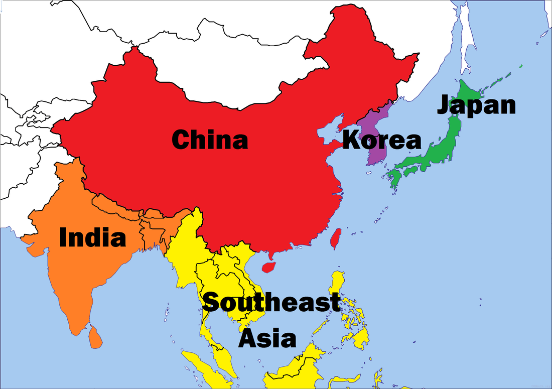
In Asia there are five very broad regions to define. In this unit you will have opportunities to learn about the common historical events, interactions, and cultures that linked the different civilizations in the regions of China, India, Southeast Asia, Korea, and Japan.
DIRECTIONS:
To create your Asia reference map you may either use the physical map in your textbook found on pages A20-A21 or the physical map found at the CIA World Factbook.
First, label and draw the following features on your map:
Next, label the oceans and cardinal directions:
Finally, color your map like the example below and label the region as shown.
LEARN THIS:
Borders and territory were not as clearly defined before the modern age. Today, the lines on a map are firm boundaries between different countries. Instead we think in terms of large regions which share common cultural and political characteristics to organize our thoughts about different historical civilizations and their location.
In Asia there are five very broad regions to define. In this unit you will have opportunities to learn about the common historical events, interactions, and cultures that linked the different civilizations in the regions of China, India, Southeast Asia, Korea, and Japan.
DIRECTIONS:
To create your Asia reference map you may either use the physical map in your textbook found on pages A20-A21 or the physical map found at the CIA World Factbook.
First, label and draw the following features on your map:
- Ganges River
- Himalaya Mountains
- Huang He River
- Indus River
Next, label the oceans and cardinal directions:
- Indian Ocean
- Pacific Ocean
- East, South, West (label the compass arrows)
Finally, color your map like the example below and label the region as shown.